Vodnikov Vrsac (WS exit) : Différence entre versions
De Topo Paralpinisme
(→Acces: 3h) |
|||
| (3 révisions intermédiaires par le même utilisateur non affichées) | |||
| Ligne 9 : | Ligne 9 : | ||
== Acces: 3h == | == Acces: 3h == | ||
| + | |||
| + | Tous les détails: https://www.hribi.net/gora/vodnikov_vrsac_vrsac_nad_zadnjico/1/2072 | ||
| + | |||
| + | Parking Coordonnées GPS: 46.38247, 13.76048 | ||
Exit Coordonnées GPS: 46.362426, 13.796141, 2223m | Exit Coordonnées GPS: 46.362426, 13.796141, 2223m | ||
| Ligne 45 : | Ligne 49 : | ||
| | | | ||
|} | |} | ||
| + | |||
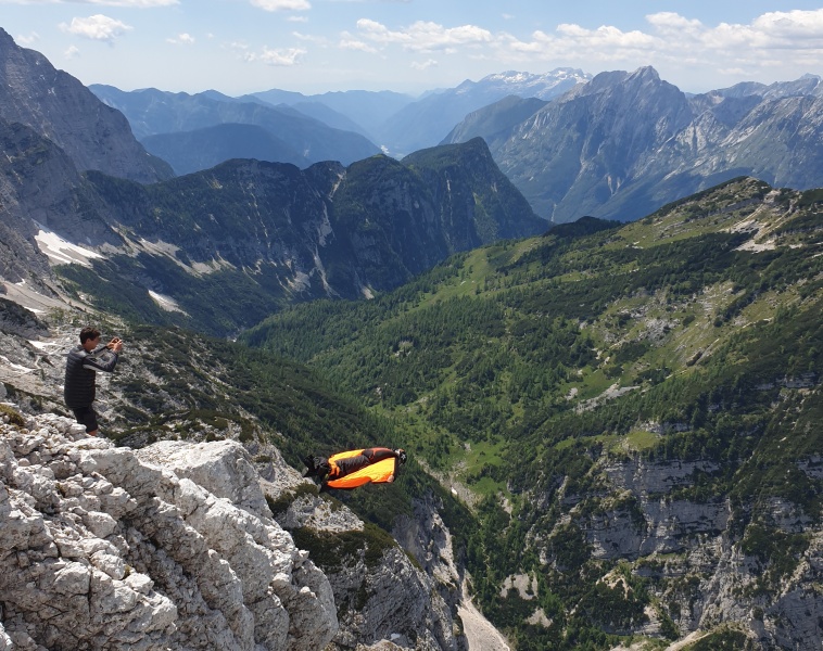
| + | [[Fichier:VV.jpg|758px]] | ||
== Remarque == | == Remarque == | ||
| − | There's also a monosuit exit nearby (from the ledge below, rope in place | + | There's also a monosuit exit nearby (from the ledge below, rope in place to abseil down, laser TBC). |
| − | Inside Triglav National Park | + | Inside Triglav National Park. |
<gallery> | <gallery> | ||
Version actuelle datée du 20 janvier 2024 à 17:33
Caractéristiques
- Lieu : Vodnikov Vrsac dans la vallée de Zadnjica
- Orientation : Nord-Ouest
- Hauteur : 1400m
- Matériel : Rien
- Posé : Champs
- Première :
Acces: 3h
Tous les détails: https://www.hribi.net/gora/vodnikov_vrsac_vrsac_nad_zadnjico/1/2072
Parking Coordonnées GPS: 46.38247, 13.76048
Exit Coordonnées GPS: 46.362426, 13.796141, 2223m
Utilisez une carte et suivez le GPS :)
| Deniv | Avancée | Commentaire |
|---|---|---|
| 66m | 8m | |
| 165m | 25m | |
| 186m | 40m | |
| 307m | 86m | |
| 370m | 151m | |
| 764m | 420m |
Remarque
There's also a monosuit exit nearby (from the ledge below, rope in place to abseil down, laser TBC).
Inside Triglav National Park.

